KZN Tornado: Should Durbanites be concerned? Meteorologist explains
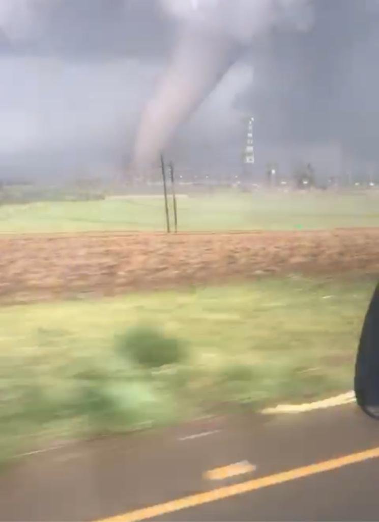
The tornado that ripped through New Hanover on Tuesday has sent shockwaves through KZN. The video was taken and shared widely on social media. Darren, Keri, and Sky spoke to a meteorologist from the South African Weather Service for more details.
Listen to the full interview, or read below:
Meteorologist Wisane Kululeke unpacked the details of the tornado that ripped through parts of New Hanover. It left many injured and collapsed homes.
Also read: SA Weather Service confirms KZN Midlands hit by Tornado
Forecaster Wiseman Dlamini from SAWS said: "At this stage, we can confirm that there was a severe thunderstorm over New Hanover, which developed and formed a tornado. The winds that were driving the storm was quite strong, ranging between 25 and 37 km/h and eventually, a tornado was formed."
Also read: KZN rains claim two more lives
Kululeke said that during summer there are a lot of thunderstorms, and as long as there are thunderstorms there is a possibility of tornadoes. He also advised that listeners fact check and verify the information that is being circulated.
According to a report from SAWS, over the central and eastern parts of KwaZulu-Natal, heavy rain is expected to lead to flooding of roads and settlements both formal and informal, which may result in some communities being displaced and left inaccessible. There is an extreme danger to life, due to fast-flowing rivers, there is also a possibility of mudslides/landslides and soil erosion, especially along highly-elevated areas, which may lead to further disruption.
Full details in the podcast.
I just witnessed a Tornado peoples lost their homes here In Pmb, Empolwen pic.twitter.com/mv8qH04EoS
— LIGHT ROOM PHOTO EDITING SPECIALIST (@faces_li) November 12, 2019
I just witnessed a Tornado peoples lost their homes here In Pmb, Empolwen pic.twitter.com/mv8qH04EoS
— LIGHT ROOM PHOTO EDITING SPECIALIST (@faces_li) November 12, 2019